The Leavenworth, Pawnee and Western Railroad was initially authorized by the Kansas Legislature in 1855, and changed the name to the Union Pacific Eastern Division in 1863.
Construction began in Kansas City in September 1863. The original goal was to meet the Central Branch Union Pacific Railroad somewhere near Clay Center, Kansas.
In 1864, the first 40 miles of line between Kansas City and Lawrence was placed into operation. During the fall of 1866, the railroad extended again to Junction City, and reached Salina the following year.
The planners of the railroad realized it would be far more profitable to reach Denver instead of ending at the originally intended Fort Riley. Citizens lobbied heavily to extend the railroad even further west.
Reorganized as the Kansas Pacific, an extension towards Colorado began building west from Salina in 1869. When the railroad reached Kit Carson, Colorado the following year, the KP began building east from Denver. The two railroads met at Strasburg, Colorado in August 1870.
Because the western segment from Denver to Strasburg originally connected with another railroad, the meeting at Strasburg was the first time the east and west coast were connected by railroad, including a bridge over the Missouri River, which did not exist at that time in Omaha.
In 1874, Jay Gould gained control of the KP, and was reorganized as the Union Pacific Railroad. Other than track upgrades, the line saw little change since the 1870 connection.
Today, UP continues to operate the line in four subdivisions. The eastern portion of the Kansas Subdivision extends from Kansas City to Topeka, the Salina Subdivision extends from Topeka to Salina, the Sharon Springs Subdivision extends from Salina to Sharon Springs, and the Limon Subdivision extends from Sharon Springs to Denver.
06/26/21
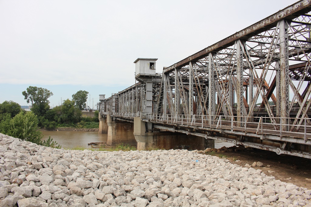
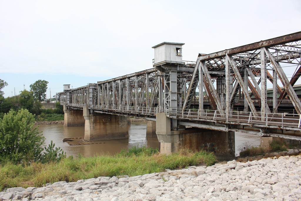
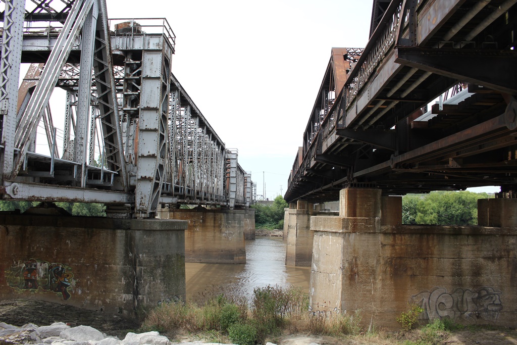
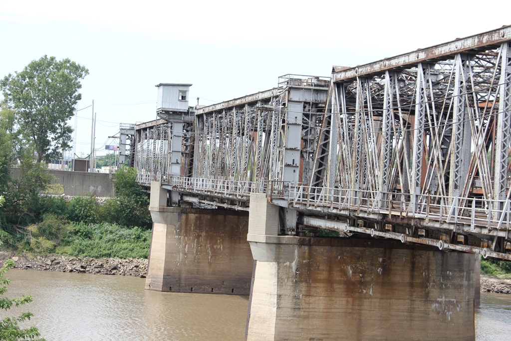
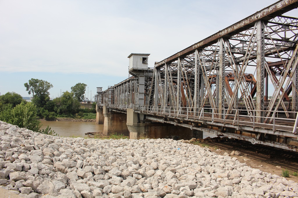
Crossing under the freeway viaduct of I-670 are a pair of massive through truss structures, carrying almost all Union Pacific traffic from east to west.
This span is the southern of the two, and is right alongside the Former Missouri Pacific Bridge.
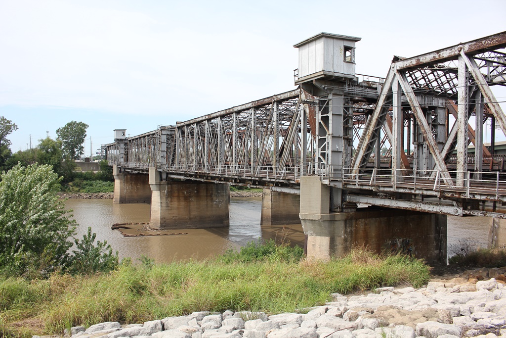
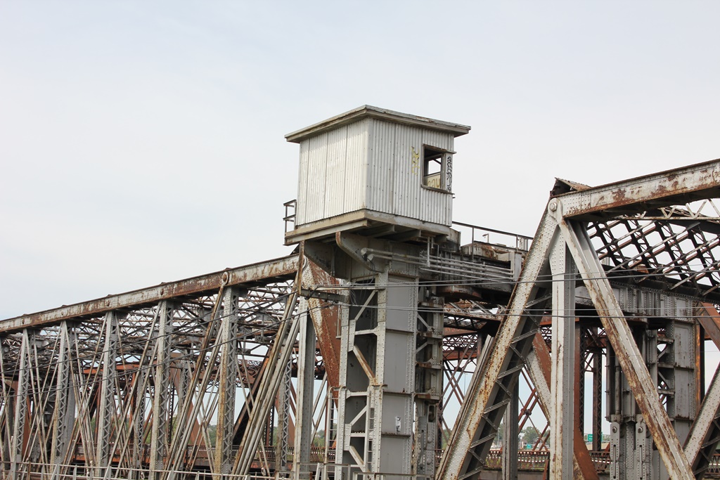
The structure here was originally built in 1903 to replace a single track structure that was destroyed in the flood of 1951. This bridge featured a trio of 180 foot spans.
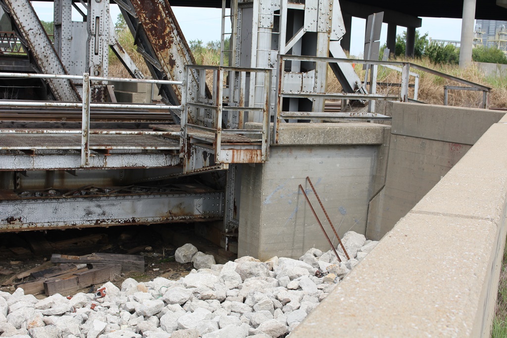
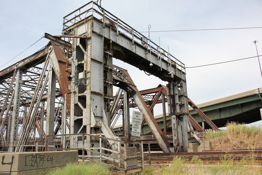
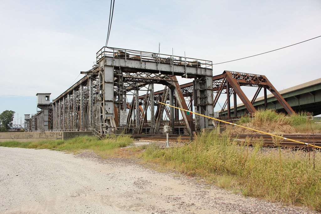
By 1911, engineers had made the determination that the Union Pacific and Missouri Pacific bridges must be rebuilt with an additional 196 foot span on each end. In addition, a small I-Beam span was added along the backside of the levee at a later date.
Both bridges would be shifted using falsework and a very small margin for error. More about this process can be read Here.
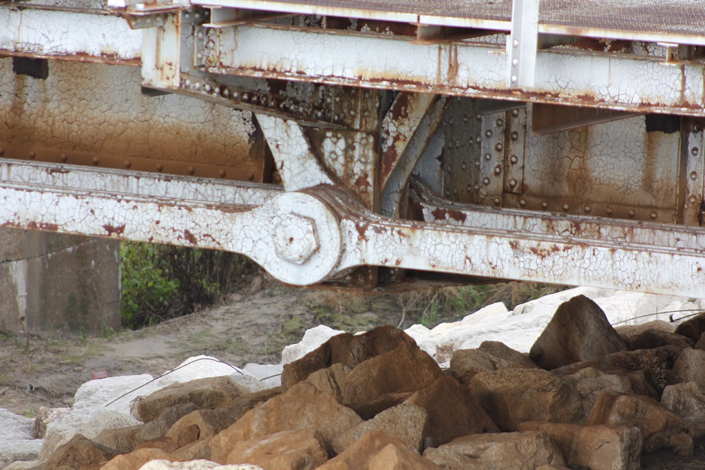
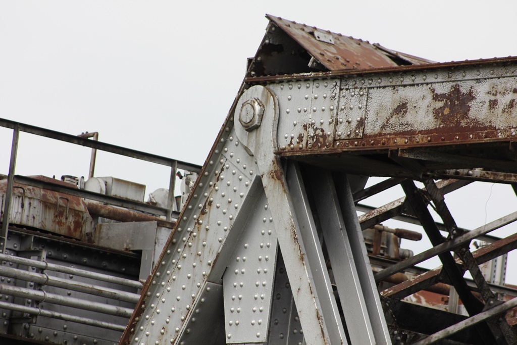
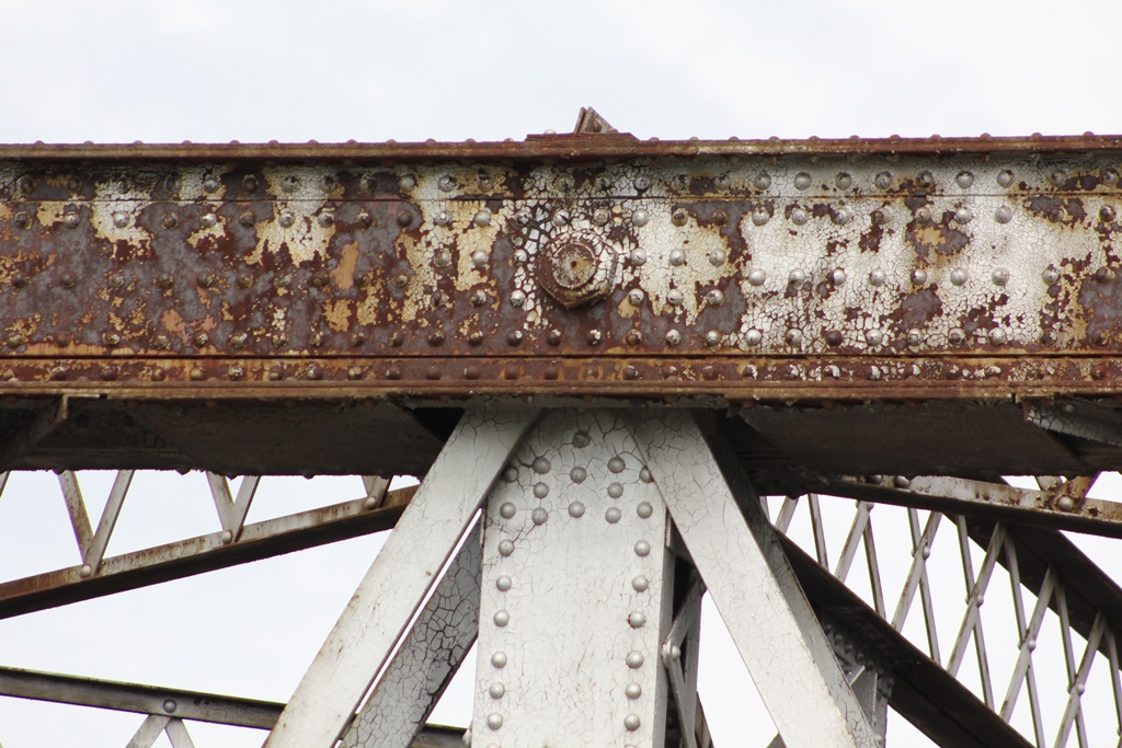
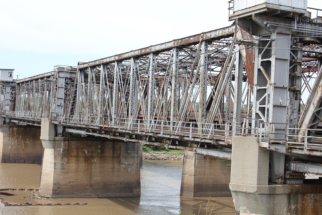
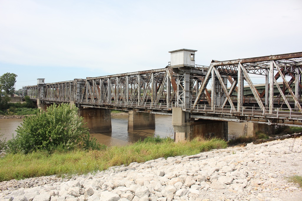
Currently, the structure consists of a trio of 10-panel, pin connected Pratt Through Trusses. These spans were originally constructed in 1903. An 8-panel truss of the same design was added to the west end in 1911; and appears very similar to the 1903 spans. The bridge rests on substructures built in 1911.
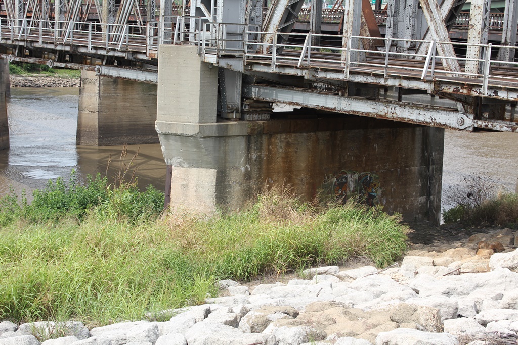
The Kansas River has a reputation for flooding quite often. Fortunately for this bridge, it has survived every major flood largely intact. A screw jack lift system was installed after the mega flood of 1951; which destroyed bridges in Topeka.
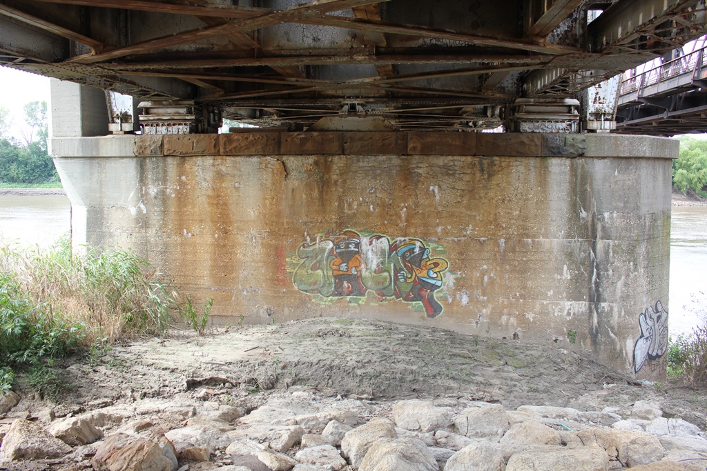
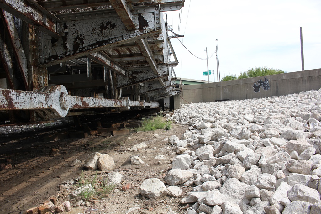
The bridge remains in an overall good condition, and is heavily used. The bridge has a high level of security, with cameras in every direction. The author accessed this bridge on the east end, by walking inside the levees. Plans are in the works for a trail alongside the west bank of the river, which would make access significantly easier.
The author has ranked this bridge as being moderately significant due to the large span length and great historic integrity.
The photo above is an overview from the east bank. The author hopes to return for better photos in the near future.
| Upstream | Armourdale Rail Bridge |
| Downstream | UP Kansas River Bridge #3 |